Independent Geoscience Specialists · Perth & Accra

Ground engineering across the full mine lifecycle

Askopite Resource Services delivers integrated geotechnical, mine water management, surveying and wireline borehole logging — optimised, value-adding solutions for the mining industry, from exploration through to closure.

0 Continents of Project Experience
0 Commodities — Gold, Iron Ore, Base Metals & More
0 Global Offices — Perth & Accra
0 Commitment to Zero Harm
Creating value through ground engineering

A single, accountable partner from collar to closure

Incorporated in Perth, Australia and Accra, Ghana in 2021, Askopite is an independent geoscience establishment providing specialised, end-to-end geotechnical, geological and hydrogeological services to the mining and construction industries — built on decades of multi-commodity experience across five continents.

We pair global technical pedigree with in-region delivery, working collaboratively with drill & blast, survey and water teams to turn every metre drilled into decision-ready engineering intelligence.

Our Services

Eight integrated practice areas

Multidisciplinary expertise delivered as one connected service — not siloed offerings.

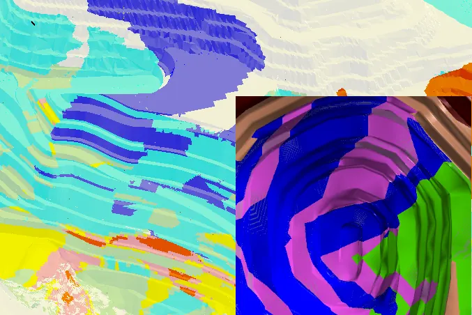
Geotechnical block model01

Mining Geotechnical

Rock-mass characterisation, slope and excavation design, and stability analysis for open pit and underground operations.

  • Open pit & underground design
  • Rock mechanics & domaining
  • Numerical modelling (RS2/RS3, Map3D)
Mine dewatering and water management02

Mine Water Management

Numerical groundwater modelling and integrated water-balance studies for mining, environment and energy.

  • Dewatering & depressurisation
  • Pore pressure & pit-lake modelling
  • Impact assessment & compliance
ALT acoustic and optical televiewer probes from Askopite's wireline fleet03New

Wireline Geophysical Logging

Our own ALT probe fleet, run and interpreted by our own engineers: oriented, in-situ borehole data for mining, exploration and infrastructure clients.

  • ATV · OTV · FWS · Natural Gamma
  • Structure, RQD, RMR, Q & GSI inputs
  • WellCAD processing, calibrated to core
Explore wireline →
Open pit mine survey04New

Mine & Engineering Survey

A dedicated geomatics team delivering mine, engineering and bathymetric / aerial survey services.

  • Laser scanning & UAV surveys
  • Volume / stockpile & void mapping
  • Topographic, cadastral & bathymetry
Explore surveying →
Mine closure landform05

Mine Closure

Risk-based geotechnical and hydrogeological support for closure structures across the mining cycle.

  • Integrated closure planning
  • Rock-mass degradation analysis
  • Waste dumps, voids & landbridges
Geobotica NanoRadar on a Smart Solar Box monitoring a slope06Dealer

Instrumentation & Monitoring

Monitoring programs designed, installed and reviewed by one team, plus on-site operational support. Authorised Geobotica dealer.

  • Geobotica NanoRadar, GeoPoint & GeoLidar
  • Radar, prisms, TDR, SAA, VWPs, InSAR
  • Telemetry, inspections & audits
Explore monitoring →
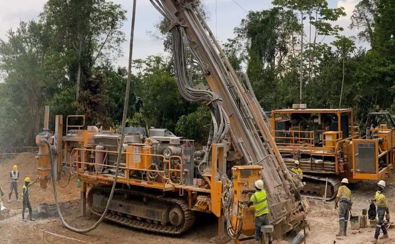
Exploration drilling rig on site07

Resource Definition & Project Management

Field programs, target generation and end-to-end coordination of logistics, expenditure and reporting.

  • RC & diamond drilling programs
  • Soil sampling, pitting & trenching
  • Logistics & technical reporting
Technical training and mentoring08

Technical Learning & Development

Tailored mentoring and training for site geotechnical engineers — from core logging to software.

  • Geotechnical awareness training
  • RocScience, Vulcan, QGIS, GEM4D
  • Hazard ID & risk communication
Across the Full Mine Lifecycle

From exploration to closure

01

Explore

Target generation, drilling programs, data acquisition & resource definition.

02

Study & Design

Scoping to feasibility, rock-mass characterisation, slope & excavation design.

03

Operate

On-site support, instrumentation, monitoring, surveying & technical audits.

04

Close

Risk-based closure planning, landform stability & long-term monitoring.

Capability Detail

Full-spectrum technical capability

Select a discipline to explore what our team delivers.

  • Geotechnical drillhole design & site investigation management
  • Diamond core logging & interpretation
  • Sample selection, testing & interpretation
  • Wireline logging with our own ALT probes: ATV, OTV, FWS & gamma (see Wireline)
  • Window / cell, traverse / line mapping
  • Outcrop & structural mapping
  • Data validation & QAQC
  • Database design, setup & management
  • Project scoping & management
  • Conceptual & Order-of-Magnitude studies
  • Pre-Feasibility & Feasibility studies
  • Bankable & Implementation studies
  • Rock mass characterisation & domaining
  • Failure mechanism identification
  • Stability analysis — pits, waste dumps & stopes
  • Design risk assessment & communication
  • Technical reporting
  • 2D & 3D finite element modelling (RS2, RS3)
  • 3D boundary element modelling (Map3D)
  • Stress analysis & stope sequencing
  • Spatial analysis of samples & compositing
  • Geotechnical block model construction
  • Estimation (Inverse Distance, Ordinary Kriging)
  • Design parameter estimation (UCS, RMR, MRMR)
  • Numerical groundwater (solute transport) modelling
  • Dewatering & depressurisation studies
  • Pore pressure modelling
  • Pit lake modelling
  • Groundwater & surface water impact assessments (incl. GDEs)
  • Environmental impact assessments
  • Water supply investigation & development
  • Aquifer test analysis
  • Wellfield design & optimisation
  • Site water management
  • Integrated water-balance modelling
  • Compliance monitoring & reporting
  • Risk-based geotechnical & hydrogeological closure support
  • Integrated closure planning across the mining cycle
  • Material characterisation, testing & monitoring
  • Rock-mass degradation & long-term void stability analysis
  • Closure of waste dumps, stockpiles, pits, voids & landbridges
  • Alignment to relevant country regulations
  • On-site operational support & mentoring
  • General contract works — short-to-medium term coverage
  • Review of site geotechnical models (rock-mass & structural)
  • Reconciliation & back-analysis of Falls of Ground
  • Geotechnical incident investigations
  • Business conformance audits & external peer reviews
  • Seismicity design, processing & analysis
  • Custom hazard reporting tools (GHAT)
  • Geobotica NanoRadar, GeoPoint & GeoLidar, as an authorised dealer (see Monitoring)
  • Deformation monitoring — open pit & underground
  • Prisms, TDR, extensometers, inclinometers, SAA
  • Radar (GroundProbe, Reutech MSR, IDS)
  • Uniaxial & triaxial geophones
  • Groundwater & pore-pressure monitoring (VWPs, standpipes)
  • Drone reality models & laser scanning
  • InSAR & remote deformation analysis
  • 3D volumetric analysis & DEM/topo
  • Telemetry to off-site, inspections & monitoring review
  • Technical mentoring & training for site engineers
  • Geotechnical awareness & hazard training
  • Drillhole design & core logging
  • Sample selection & material testwork
  • Risk assessment & communication
  • RocScience (Dips, RSData, RocPlane, SWedge, Slide, RS2/RS3)
  • Vulcan, GEM4D, QGIS visualisation
  • Geotech Hazard Assessment Tool (GHAT)
Flagship Capability

Wireline Geophysical Logging

Our own ALT probe fleet, owned and operated by Askopite in-country, run and interpreted by the same engineers who design with the data. The only West-African provider that both logs the hole and designs with it.

Trays of diamond drill core laid out for geotechnical logging Laptop showing televiewer image logs being processed and calibrated against core
Core Part of the story
Illustrative acoustic televiewer log strip Schematic unrolled 360-degree borehole wall image from north through east, south and west back to north, between 120 and 127 metres depth, with banded rock and six sinusoidal fracture and bedding traces. Two are highlighted with dip and dip-direction labels of 41 degrees towards 308 and 62 degrees towards 135. A natural gamma curve and a full-waveform sonic track, with variable-density waveform display and P-wave velocity curve, run alongside. ATV · AMPLITUDE GR FWS m N E S W N 0 – 200 APIVDL · Vp 41°/308° 62°/135° 120 121 122 123 124 125 126
Borehole Illustrative schematic, not survey data

Core tells part of the story. The borehole tells the rest.

Broken ground, core loss and failed orientations are exactly where the rock mass matters most. Televiewer and geophysical logging recover oriented, continuous, in-situ data from those intervals, and from open and percussion (RC) holes where there is no core at all.

One pass down the hole feeds resource geology, slope design and ground control. Every image log is processed in WellCAD and calibrated against core.

  • Mining
  • Exploration
  • Infrastructure site investigations
Scope a logging campaign

We don't sell probes.
We deliver answers.

Logging-only service Askopite
Hands over image files Hands over structure, rock-mass inputs and design recommendations
Interpretation left to someone else One independent geotechnical, hydro and geology team from hole to decision
The log stands on its own Calibrated against core, processed in WellCAD
Data ends at the report Picks feed slope design, ground control and resource models, built for reporting-grade workflows
  1. 01Hole

    Our own ALT probes, run by Askopite crews in diamond, RC and open holes.

  2. 02Image

    Oriented 360° ATV / OTV images, FWS and gamma, processed in WellCAD.

  3. 03Structure

    Dip / dip-direction picks, structure sets, stereonets, RQD, RMR, Q and GSI inputs.

  4. 04Design

    Slope design, ground control, resource and 3D fault models, foundation design.

Four tools. One fleet. Owned and operated by Askopite.

ATV

Acoustic Televiewer

360° oriented amplitude & travel-time imaging: structure, breakout, acoustic caliper and casing inspection in fluid-filled holes.

OTV

Optical Televiewer

True-colour 360° borehole image: lithology, mineralogy and structure in dry or clear-water holes.

FWS

Full Waveform Sonic

P- and S-wave velocities for in-situ dynamic elastic properties (Young's modulus, Poisson's ratio): rock-mass strength, rippability, blast and foundation design, plus a fracture / permeability indication.

GR

Natural Gamma

Total-count natural gamma for lithology, clay content and reliable hole-to-hole correlation.

WA

Across West Africa

Mining, exploration and infrastructure clients, including geotechnical site investigations, served in-country from our Accra office.

→

From Image to Decision

Structural picks, RQD, RMR, Q & GSI inputs, structure sets, stereonets and 3D fault models, delivered straight into your mine-planning workflow.

Supported by Geosensor Australia, authorised distributor of ALT (Advanced Logic Technology) and Mount Sopris instruments.

Industry-standard ALT / Mount Sopris probes and WellCAD processing, with Askopite's own engineers in the field and on the interpretation.

Geomatics

Mine & Engineering Surveying

Our dedicated survey team provides geomatic engineering services to clients across mining, infrastructure and the environment — from routine mine-map updates to bathymetric and aerial surveys.

Mine Survey

  • Laser scanning
  • Aerial surveys with drones
  • Volume / stockpile surveys
  • Operations & development surveys
  • Bench turnover & blast pattern surveys
  • Void mapping & map updates

Engineering Survey

  • Geodetic surveying & data management
  • Topographic surveys
  • Cadastral surveying
  • Route / road survey
  • Land boundary demarcation
  • Photogrammetry

Bathymetry & Aerial

  • UAV beach surveys
  • Remote-controlled boats with RTK GPS
  • Hydrographic survey
  • LiDAR surveys
Geological rock face mapping
Est. 2021 Perth & Accra
Who We Are

An independent geoscience house with global pedigree and West-African focus

Askopite Resource Services is an independent, end-to-end geoscience consultancy serving the mining and construction industries across West Africa and Australia. Our team is drawn from major mining operators and consultancies, with decades of experience across multiple commodities and geological settings.

Areas of Expertise

  • Geotechnical Engineering
  • Rock Mechanics
  • Mine Water Management
  • Numerical Modelling
  • Block Modelling
  • Waste Dumps
  • Mine Closure
  • Instrumentation & Telemetry
  • Wireline Logging
  • Mine & Engineering Survey
  • Resource Definition
  • Training & Mentoring

Commodities

GoldIron OreBase MetalsBauxiteUraniumGraphiteCopper
NanoRadar scan footprint fanning across an open-pit slope in a 3D terrain model
Instrumentation & Monitoring

See the ground move before it fails

We design and implement monitoring programs for open pit and underground operations, including telemetry to off-site, then stay on to inspect, review the data and communicate hazard and risk.

Geobotica Authorised Geobotica dealerGeobotica, Brisbane, Australia
Geobotica NanoRadar units with the companion app on tablet and phone
NanoRadar

Ground-movement radar for early warning of collapse

For underground and open-pit mines, slopes, tailings dams, landslides and infrastructure. Built-in WiFi with an offline mode for local alarms, and RockDetect filtering that ignores non-rock movement such as people and machinery to cut false alarms.

  • Sub-mmdisplacement precision
  • 80 m · 120°range and azimuth, open-cut
  • ~2 minbetween scans
  • IP68underground rated
GeoPoint software on a laptop showing a slope deformation heatmap and displacement time series
GeoPoint

Analysis software

Heatmaps, 3D views, velocity analysis and automated alerts, connected over WiFi, 4G or Starlink.

GeoLidar

Lidar + AI surface change

Millimetre-scale surface-change and volume monitoring, streamed to the cloud.

NanoRadar deployment options

One sensor, four ways to set it up.

NanoRadar on a folding tripod in an underground drive

Folding tripod

A compact, quick-set mount, shown here underground, where the IP68-rated NanoRadar watches the backs and walls.

The wider instrument toolkit

PrismsTDRExtensometersInclinometersShape-accel arrays (SAA)Uniaxial & triaxial geophonesRadar: GroundProbe, Reutech MSR, IDSVWPsStandpipe piezometersInSARDrone reality modelsLaser scanning

One team, end to end. Monitoring designed, installed and reviewed by the same engineers, with telemetry to off-site and periodic inspections.

Where We Work

Rooted in West Africa, connected to Australia

Headquartered in Accra with an office in Perth, and field programs in Guinea, Sierra Leone and Côte d'Ivoire.

Where Askopite worksWorld map linking the Accra headquarters in Ghana with the Perth office in Australia, with a zoomed view of West Africa showing Ghana, Guinea, Sierra Leone and Côte d'Ivoire.0201030405WEST AFRICA
Insurance & Assurance

Data and designs you can stake a decision on

Askopite operates under the following insurances (AUD). Certificates can be furnished upon request, and our teams are trained to the highest HSEC standards.

$20MPublic & Product Liability
$5MProfessional Indemnity
ZeroHarmHSEC — aligned to major-miner standards
Get In Touch

How can we assist?

Share a target hole, a programme or a project, and we'll return a tailored plan.

↑